working "in-between" planning and design: undoing mistakes
If there’s one lesson we’ve all learned working in China in recent years, it is that things get built very fast. Unfortunately that includes some fairly significant mistakes. Planning mistakes are not limited to China, however here they tend to get built before anyone can take a breath and say that there might a better way, and for whatever reason, where the landscape is concerned, they often involve water. Changsha Lakefront is one such example of a simple enough master planning move: focus a new mixed-use residential development around a manmade lake. In this case said lake was built by the government as an anchor for new development prior to the developer acquiring the rights to construct the new neighborhood. As happens so often when a master plan becomes a built place without the adequate intervening steps of design, little forethought was given to the land-water interface (the edge details) and even less to the water itself (where it would come from, how to maintain good water quality, runoff treatment, circulation, etc.). It was little more than a curvilinear asterisk on a plan indicating a central focal point—an assumed amenity—without real consideration of whether or not it would be beneficial, beautiful or healthful for the new residents. It is the landscape architect who is uniquely qualified to occupy the space between planning and detail design because of training and understanding of scale, topography and natural systems. It’s a mindset and knowledge that can’t be turned off, sometimes making very large scale planning exercises difficult for a landscape architect, or perhaps it’s an indictment of monster plans altogether.
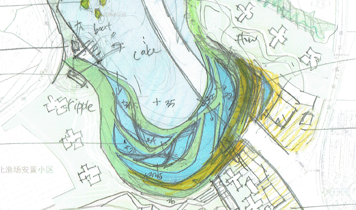
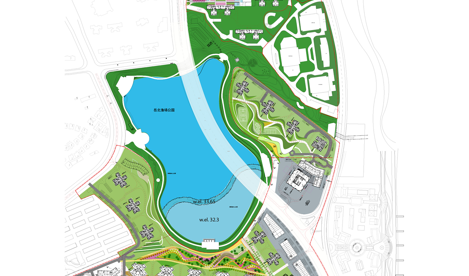
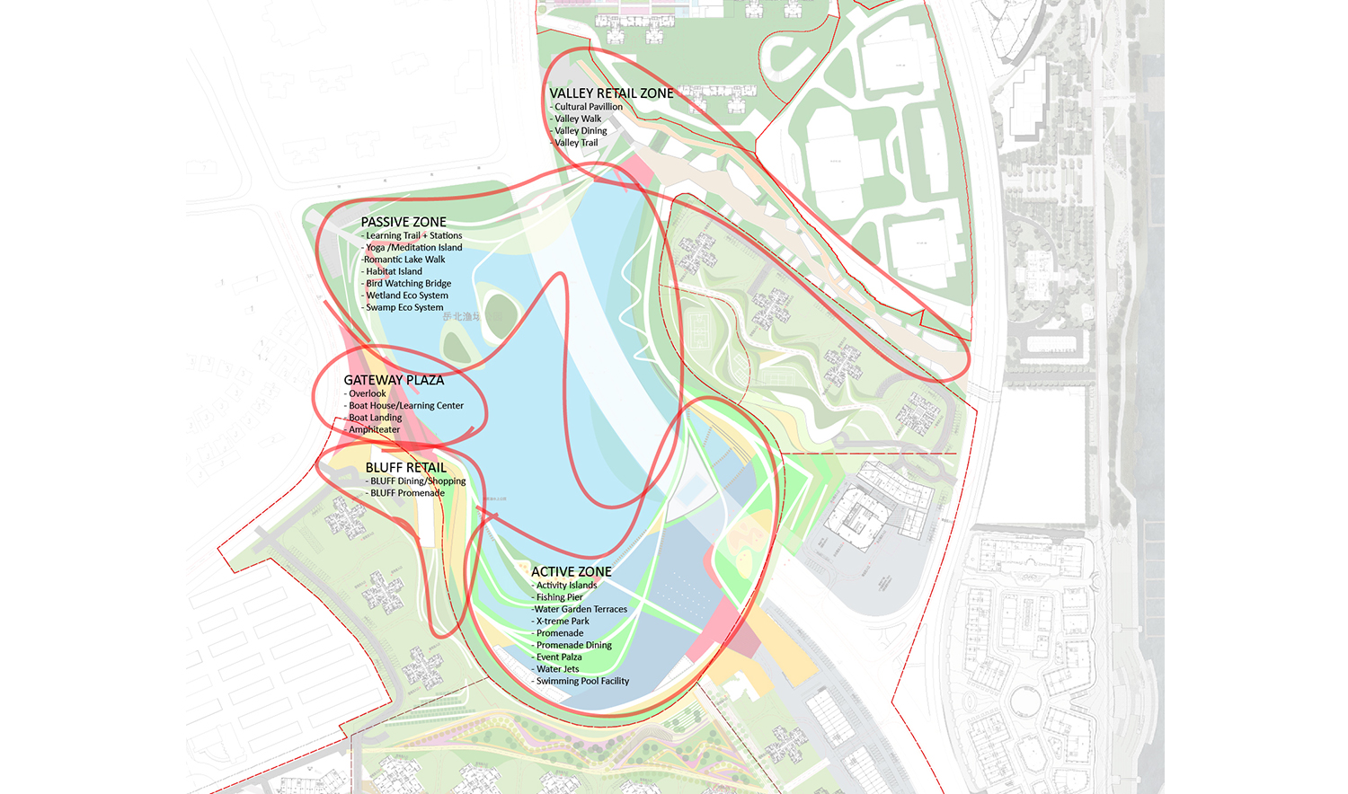
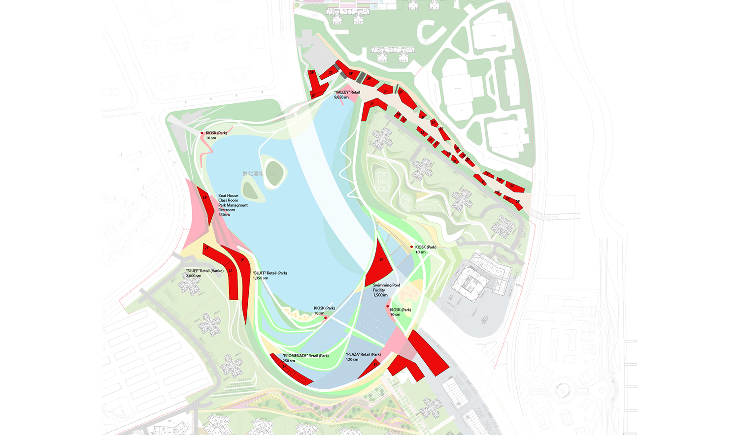
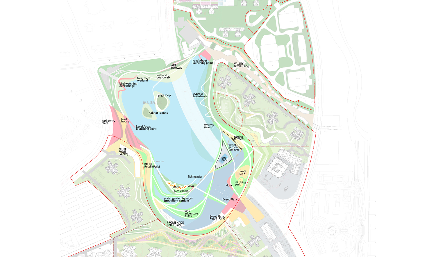
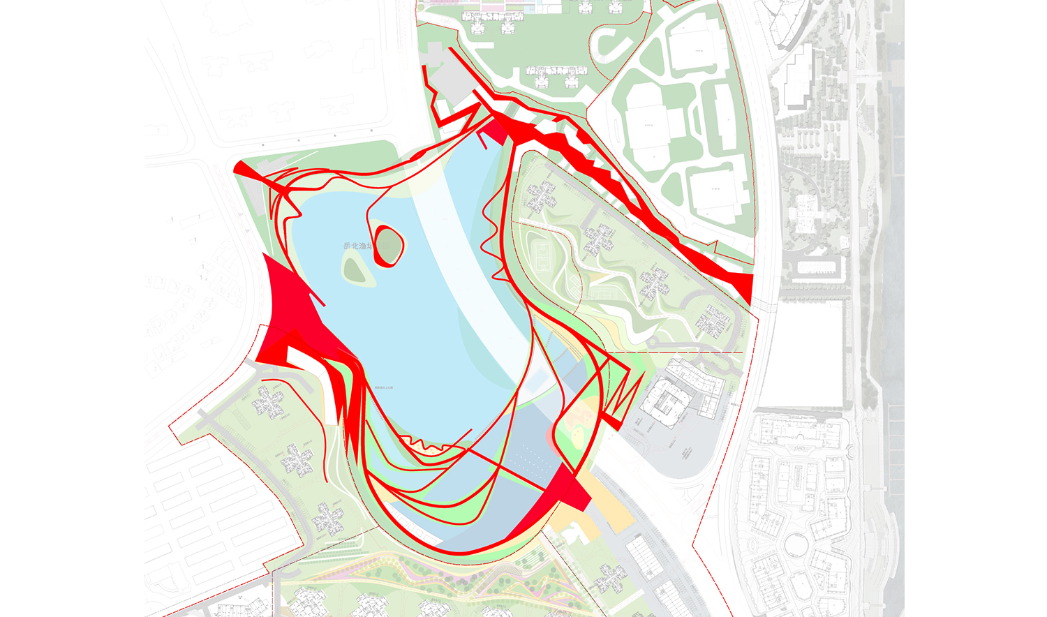
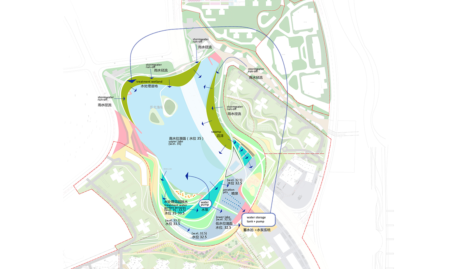
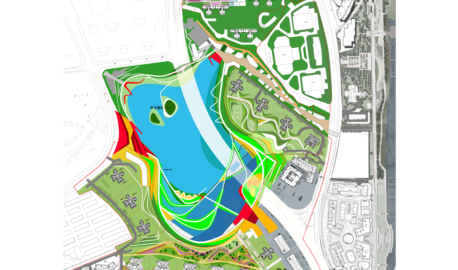
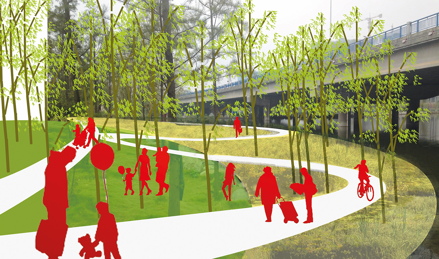
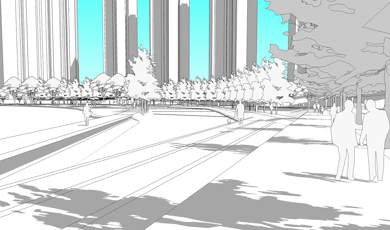
The Changsha Lakefront site is adjacent to another Vanke development, a landscape also designed by office-ma, called In the Forest . As phase one of In the Forest neared completion to positive reviews, both the developer and the government realized that the lakefront could be better. The two projects started to be considered together in nomenclature and design, referred to as In the Forest and At the Water,and office-ma was asked to generate quick ideas for addressing the lake, which had previously been outside the developer’s project boundary. The simple diagrams shown here are the result of that effort. In addition to the urban design diagrams, a SketchUp model was used primarily as an in-house design tool to confirm the various design moves scenographically; however no illustrative drawings were produced for the client, a byproduct of a rare and sophisticated professional audience—and a limited budget. The office-ma design effort was further constrained by the mandate to maintain the existing lake shoreline, a resulting shape that has no real rhyme or reason, plucked right from 19th century romantic garden design where amorphous blob equals “natural.” However, the team was allowed to manipulate edge details, propose in-water water quality measures, and develop all the landside uses, access and amenities. In exchange for reimaging and improving the lakefront the developer was granted an additional parcel by the government for retail development, which became known as the “Retail Valley,” benefiting both In the Forest and Changsha Lakefront residents.
The office-ma team started its review of the lake by examining water quality and proposing wetland treatment areas and active recirculation. The new plan introduces a highly articulated lakefront edge of boardwalks, activity islands and ponds all integrated with active and passive water treatment systems as well as landside civic and commercial areas. The lake had been developed in two elevations separated by a 2.5-meter high featureless concrete weir. The weir will now become an armature for a web of pedestrian bridges connecting to islands, boardwalks, bridges and a constructed beach. It also becomes a water feature for aeration of recirculating lake water and a visual backdrop for the southern commercial plaza. The new Retail Valley meets the lake with a kayak launch and docks at the vibrant northeast corner of the lake, while the northwestern corner is a major public access point to the park where islands create a green backdrop in the lake, creating a “harbor” of wetland park and bird sanctuary. One of the islands is strictly for wildlife habitat with no human access. The southwestern lake edge has retail and parking tucked into the slopes overlooking the lake in two levels. All aspects of the lakefront promenade become part of an integrated recreational experience; a far cry from the dot-dash-dot of plaza-trail-plaza offered by the old plan. A stroll all the way around the lake will include five different activity zones and offer no fewer than 10 different environments from busy retail plaza and urban amphitheater to a Cyprus swap where tree trunks merge with the columns of an elevated freeway.
It’s very easy to be critical of development in China as naïve on many levels, but the boldness and speed of building also extends to willingness to acknowledge and undo mistakes, and we have a professional obligation to offer criticism as well as help. Over the coming months further detail design will be developed for the lakefront park and we will post progress here.
by Steve Hanson